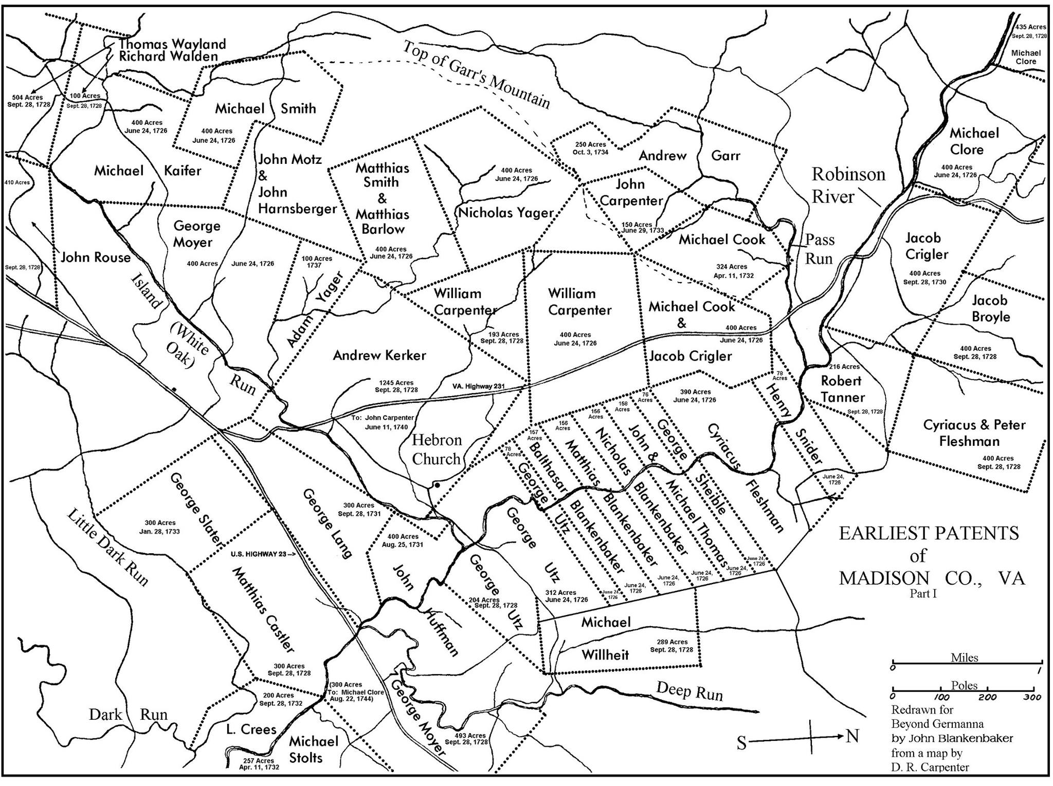
Here is an early land patent map showcasing where several Second Colony ancestors had land in the Robinson River Valley in Madison County, Virginia.
Many of the grants for land patents were between 300-400 acres. Do you see your ancestor’s family name? Click to enlarge.
Keith Amburgey says
2nd Colony namesake was Conrad Amberger although I do not see him on the map of land ownership on your website? Not trying to read into it but could someone let me know why?
Richard Hulan says
This map is identified as Part I, and only shows some patents fairly close to the Hebron church. Conrad Amberger’s 1733 patent was farther north and east, well off the area shown. And btw north is to the right, in the very partial Part I illustration. The Amberger land (most of it now in Culpeper County) is shown in Part IV with his name, and in Part VI is identified only by the number 30 (its place in the listing of Second Colony patents on the facing p. 28), all found in the Germanna Record no. 18, 2008.